
Satellite Snapshots
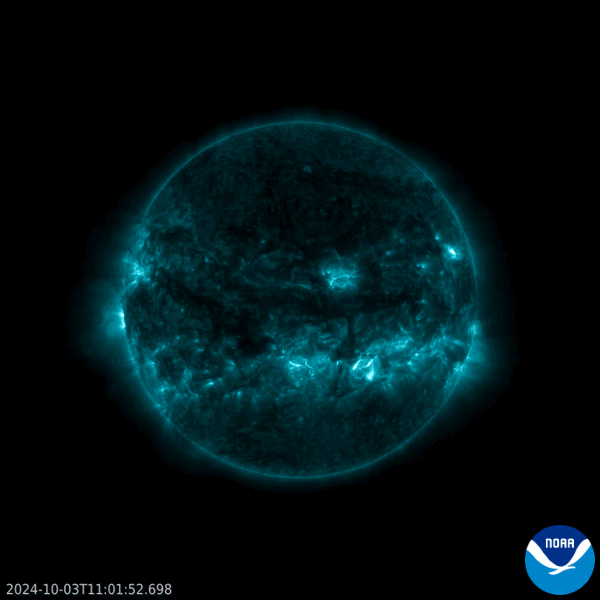
On Oct. 3, 2024, at 8:18 a.m. EDT, NOAA’s GOES East satellite captured the Sun emitting a strong solar flare, seen here as a bright patch in the lower center of this imagery.
Satellite Snapshots

Hurricane Helene made landfall in Florida's Big Bend region at 11:10 p.m. EDT on Sept. 26, 2024.
Feature Story

The USDA uses the Vegetation Health Index (VHI) generated with VIIRS data to enhance crop monitoring and analysis.
Satellite Snapshots

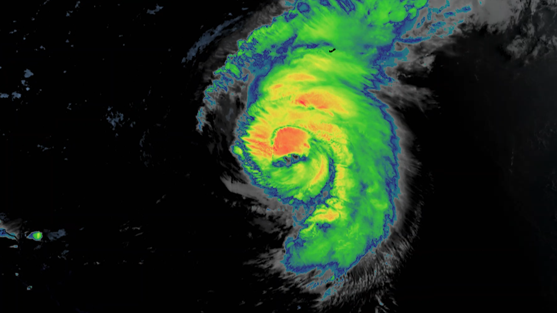
On Sept. 4, 2024, the VIIRS instrument on board NOAA’s JPSS Program satellites captured this True Color imagery of Typhoon Yagi in the South China Sea.
Earth from Orbit
Even with the storm hundreds of miles offshore, Hurricane Ernesto was still being felt Saturday along much of the U.S. Eastern Seaboard, with dangerous rip currents forcing public beaches to close during one of the final busy weekends of the summer…
Satellite Snapshots
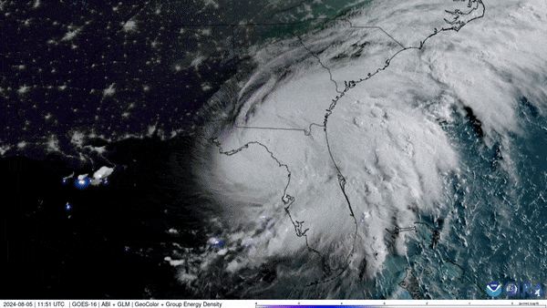
NOAA’s GOES East (GOES-16) satellite has been carefully monitoring Hurricane Debby as it travels across the U.S. state of Florida.
Earth from Orbit
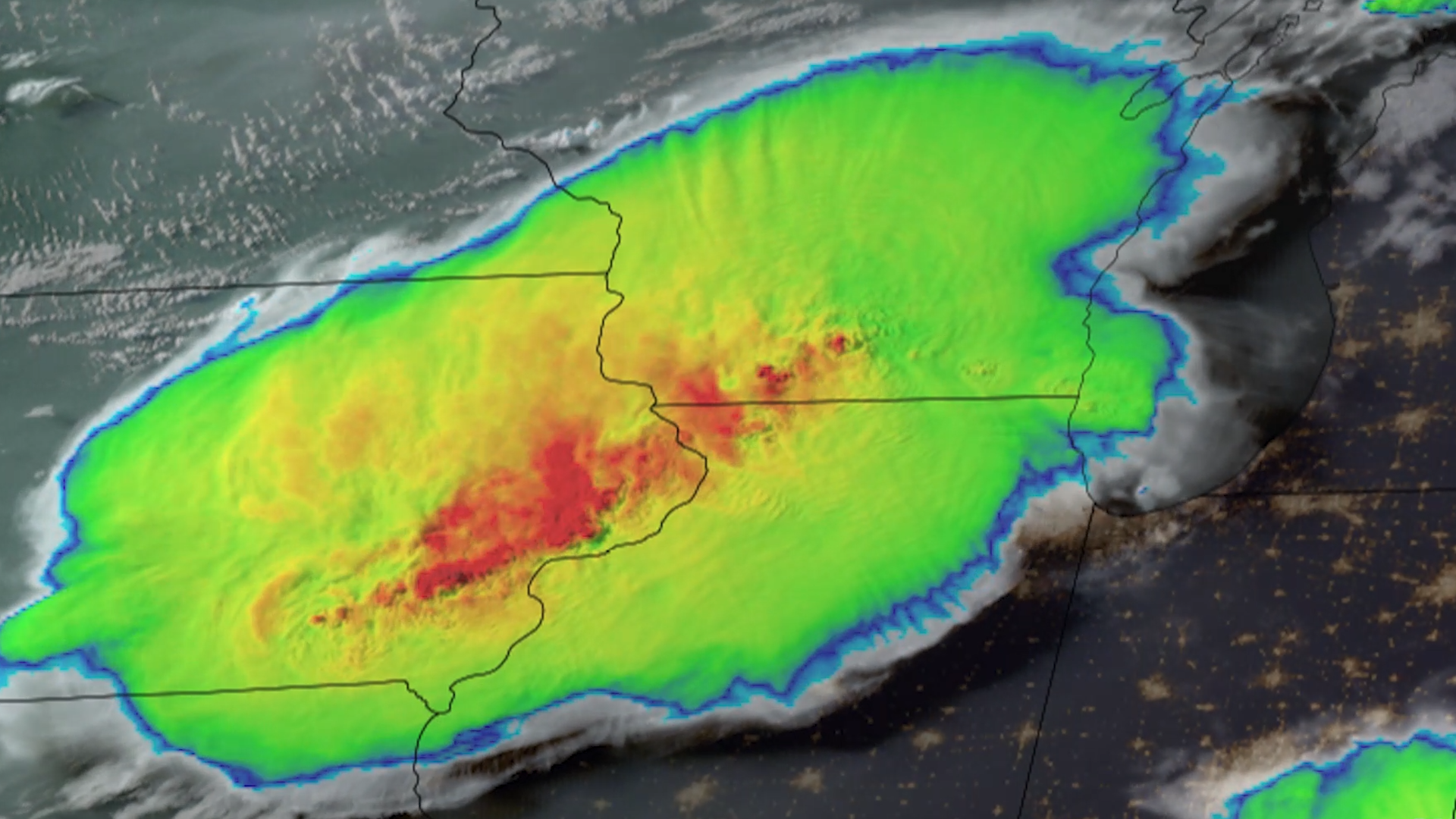
Parts of the Midwest are cleaning up after thunderstorms barreled through the region on the night of Monday, July 15, 2024, bringing hurricane-force winds and multiple tornadoes around Chicago.
Feature Story

Meet Olaf McCreary, a satellite engineer at NOAA’s Office of Low Earth Orbit Observations.