
Feature Story
Wildfires burned more than a million acres in Northern California.
Satellite Snapshots
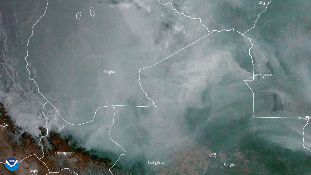
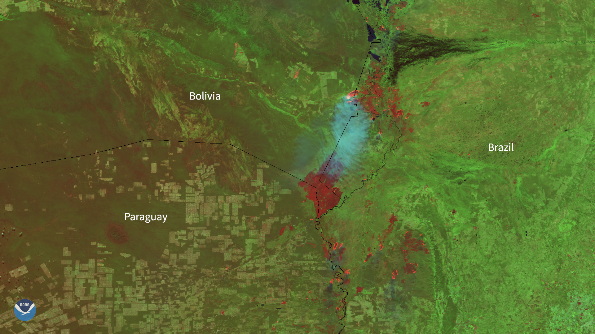
On Nov. 5, 2020, NOAA’s GOES-East satellite focused on a thick blanket of smoke billowing over forests and wetlands in central South America.
Satellite Snapshots
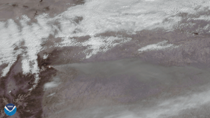
On October 14, 2020, the GOES-East satellite viewed the Cameron Peak Fire near Ft. Collins, CO, which has been burning for two…
Satellite Snapshots
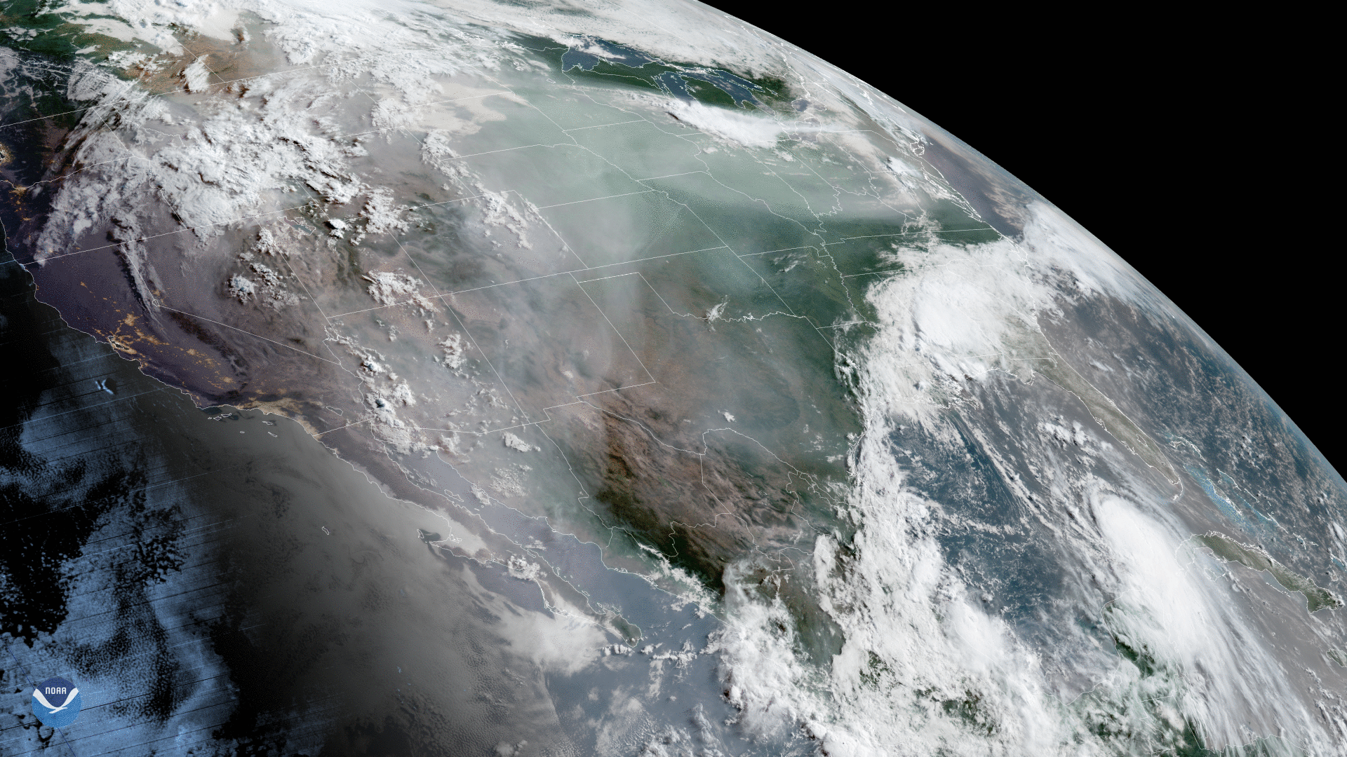
GOES-West captured this dynamic GeoColor imagery of North America, where wildfires have been ravaging…
Feature Story
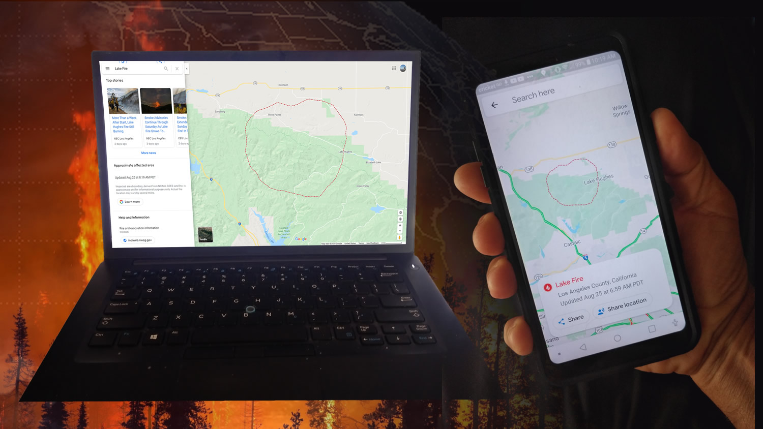
NOAA’s GOES-16 (GOES-East) and GOES-17 (GOES-West) satellites are helping the public see where active wildfires are and avoid dangerous situations.
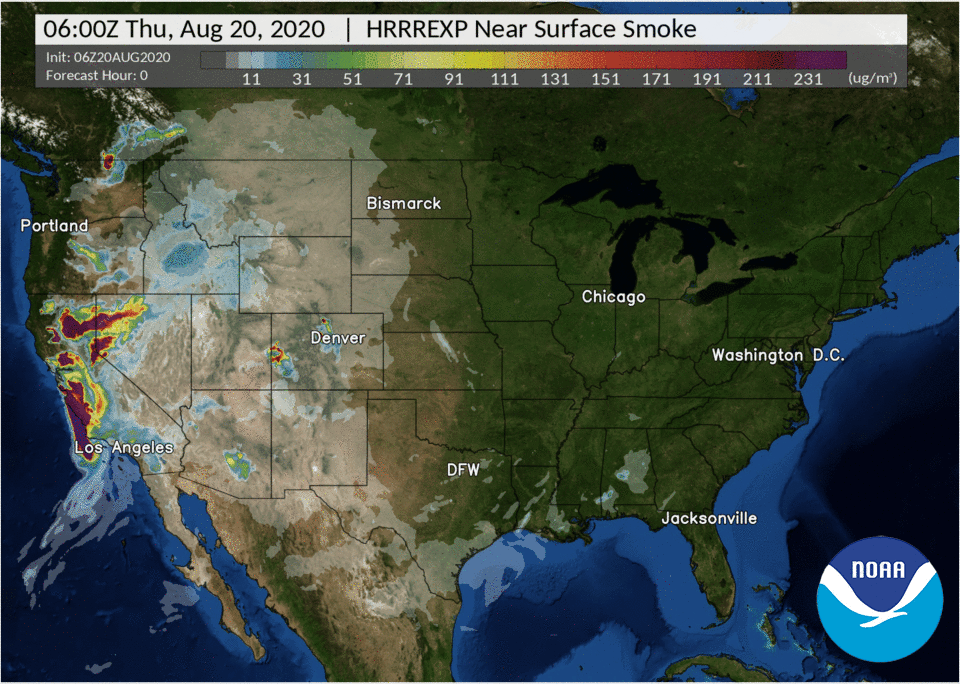
Satellite Snapshots
On Aug. 19, 2020, NOAA’s GOES-West satellite captured the above GeoColor image loop of massive wildfire smoke plumes billowing from…
Satellite Snapshots
As NOAA’s satellites focused in on South America on Aug. 7, 2020, they could see smoke plumes from various fires across the continent…
Satellite Snapshots
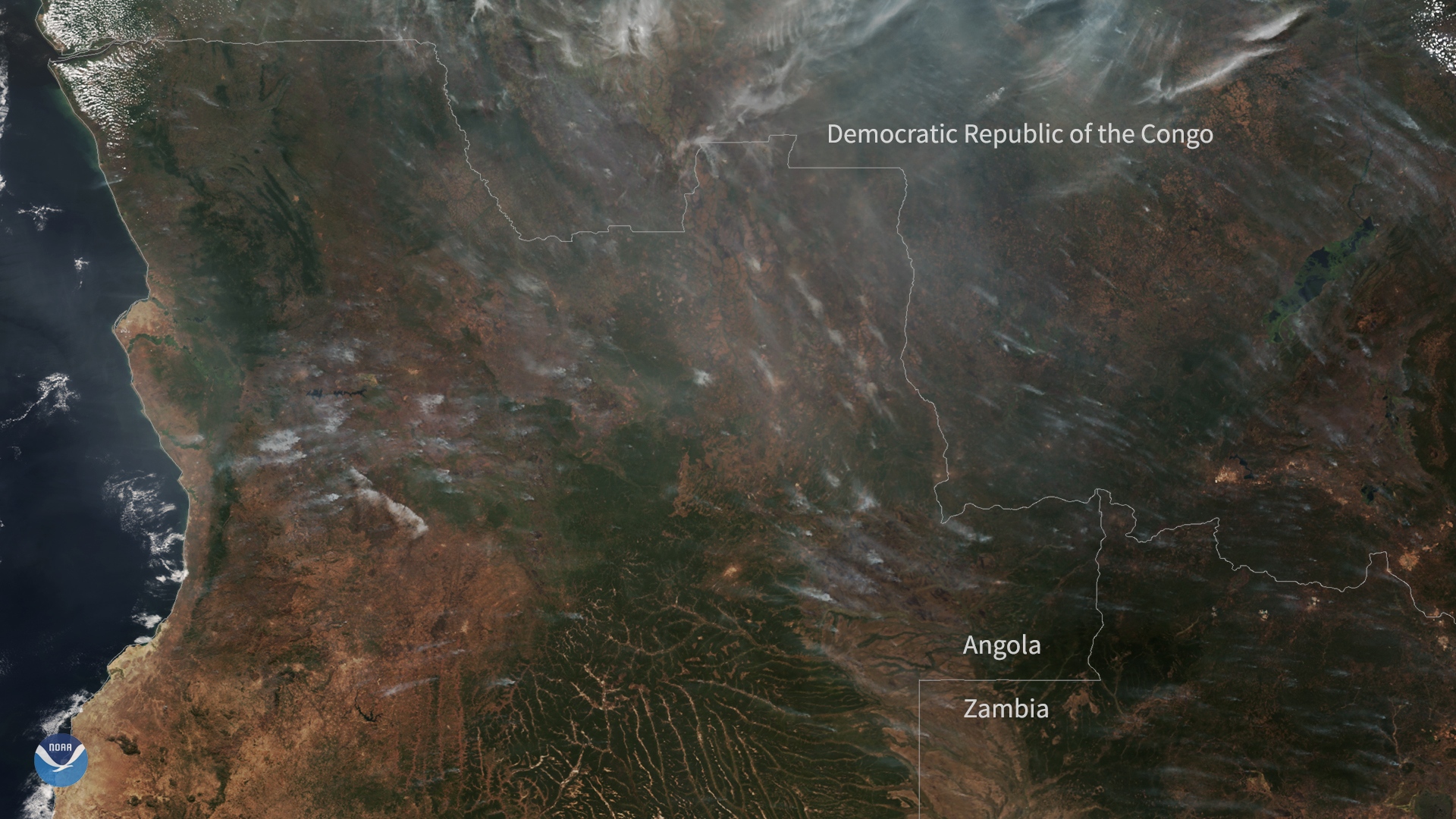
On July 5, 2020, the NOAA-20 satellite captured this True Color imagery of hazy smoke from fires burning across a large portion of central Africa.