
Satellite Snapshots
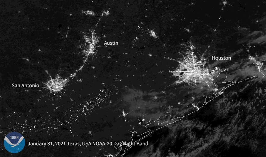
Following a historic winter storm across the central/southern U.S. this week, the NOAA-20 satellite caught the resulting power outages in Texas.
Satellite Snapshots
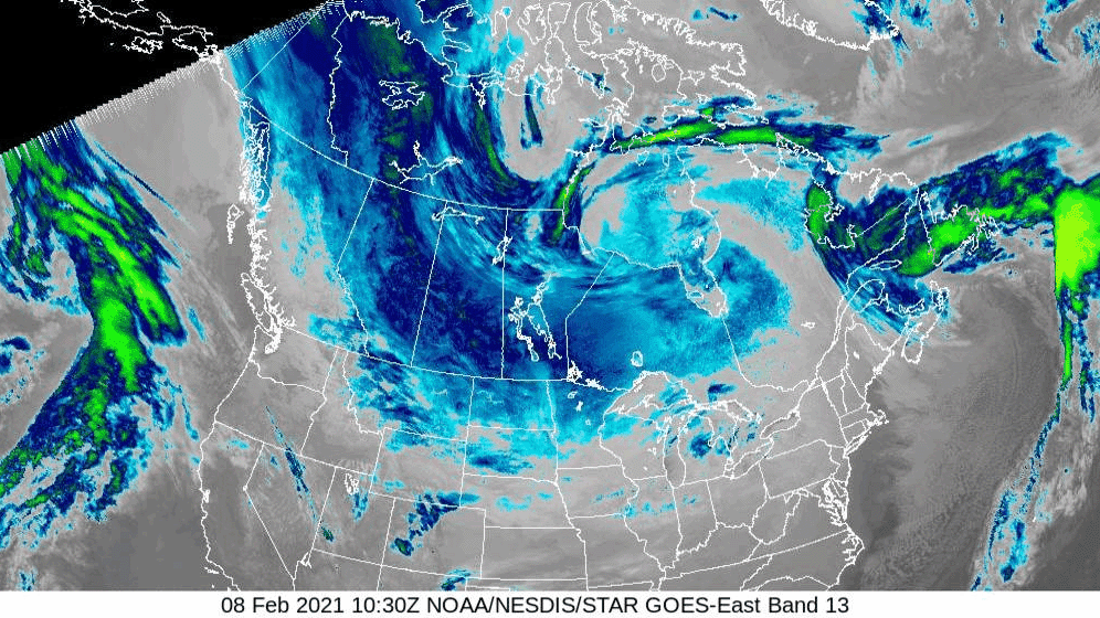
As a dip in the polar vortex continues to bring bitter temperatures to North America, the air over the northern reaches of the continent was so frigid on the morning of Monday, Feb. 8, 2021, that the GOES East satellite perceived the cold air along…
Satellite Snapshots
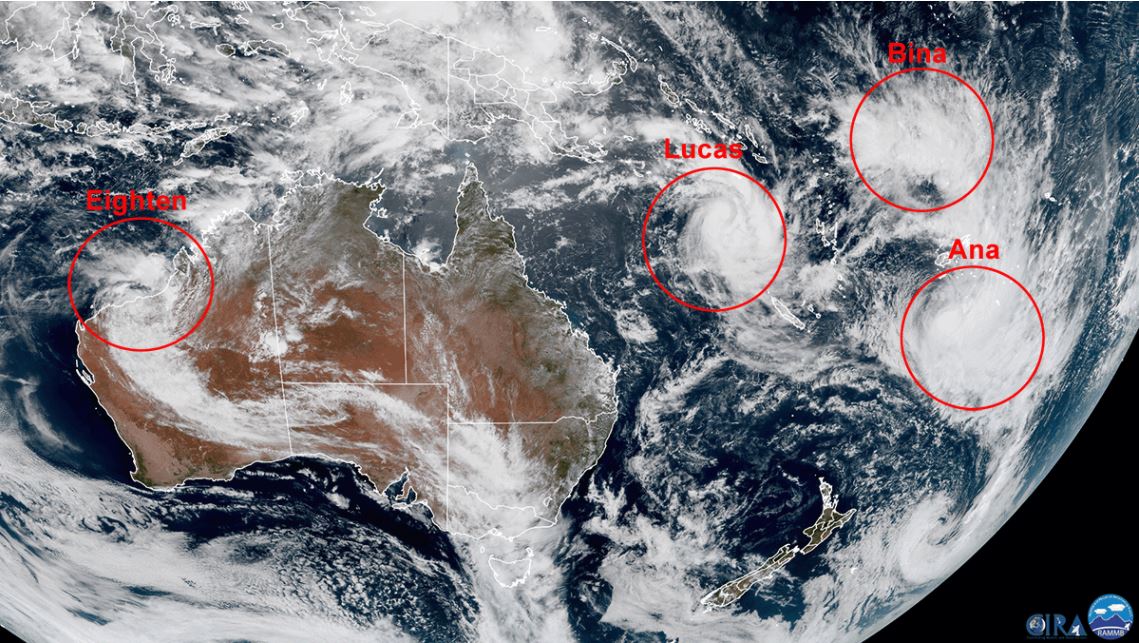
The Hmawari-8 satellite watched three cyclones churning over the South Pacific, and another pushing across Western Australia.
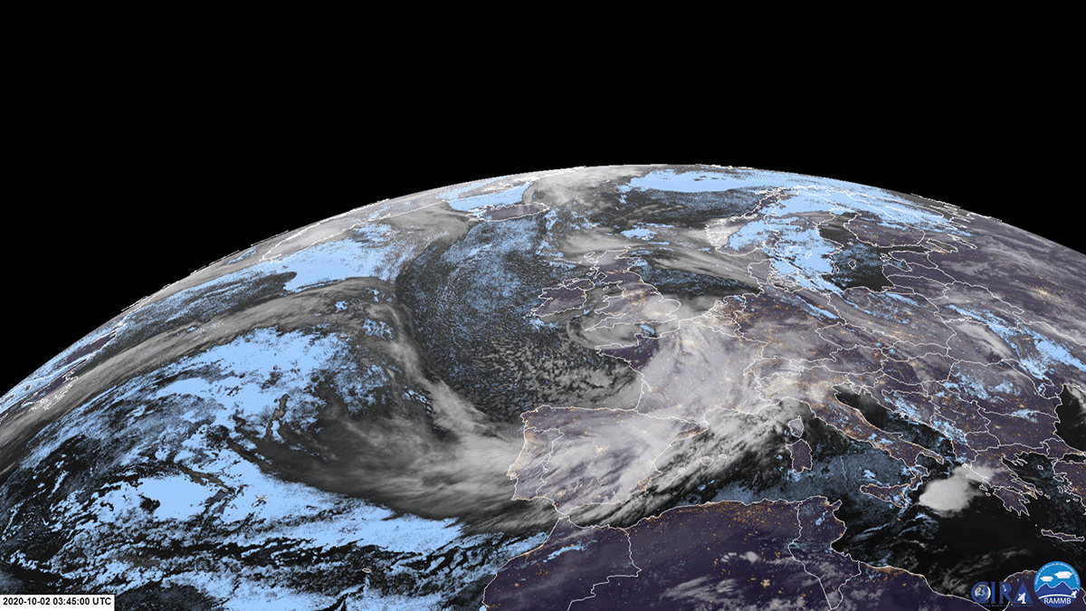
Satellite Snapshots
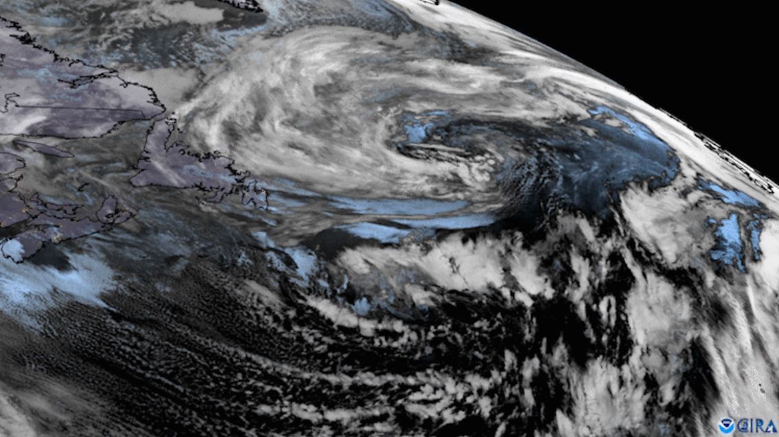
GOES East zoomed in on two low pressure systems swirling over the North Atlantic while cloud streets streamed off the North American coast.
Satellite Snapshots
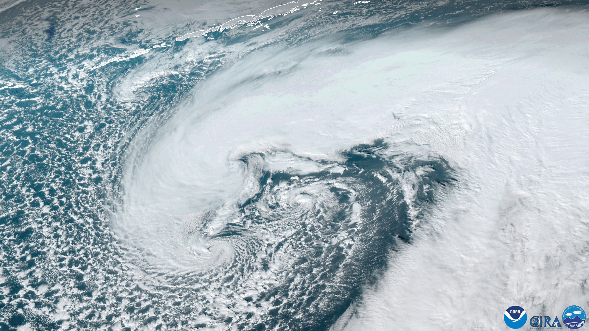
GOES West satellite captured this stunning GeoColor imagery of a strengthening mid-latitude cyclone near the Aleutian Islands
Satellite Snapshots
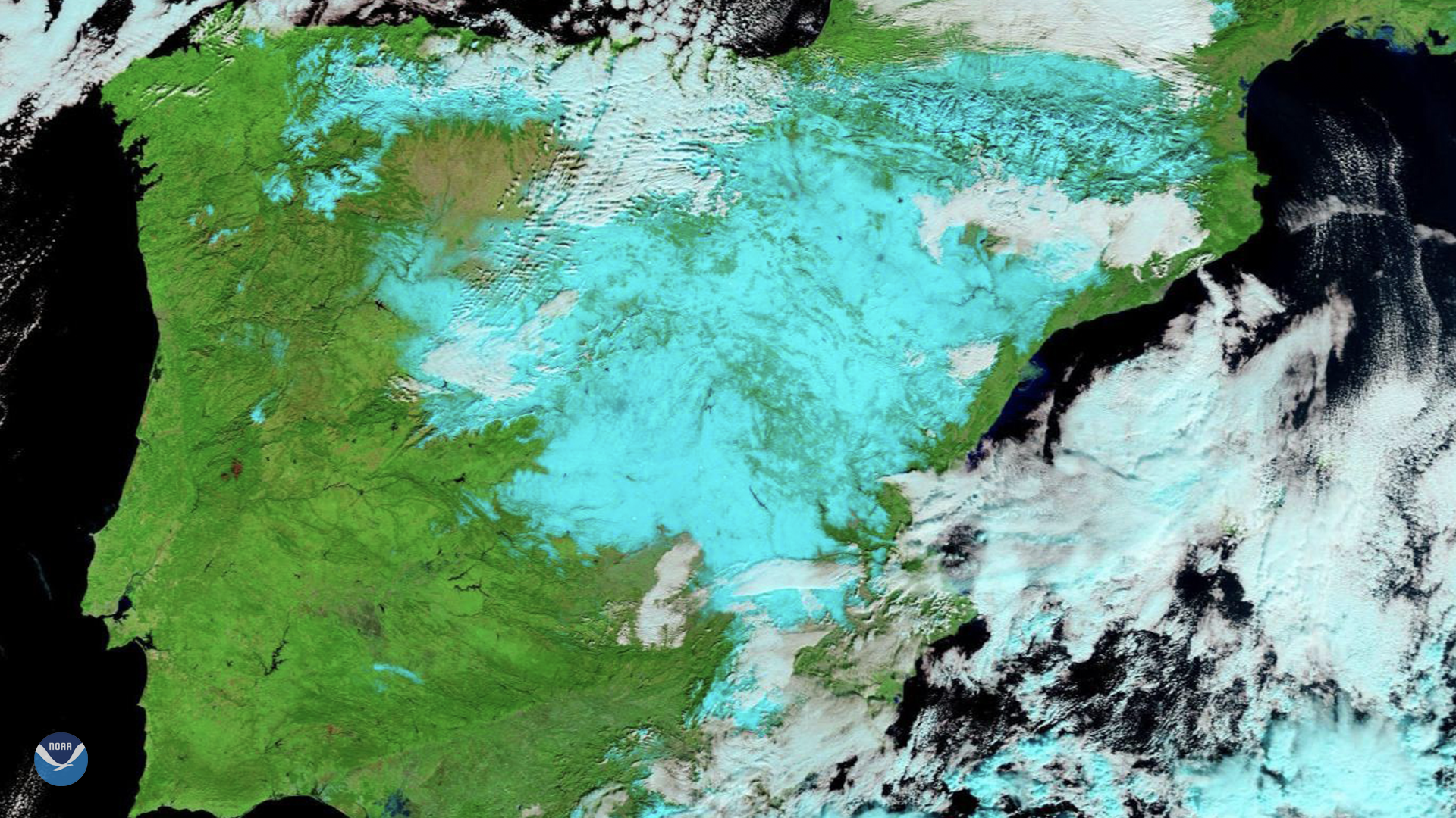
On Jan. 11, 2021, Europe’s Meteosat-11 satellite captured imagery of the aftermath of…
Satellite Snapshots

A powerful low-pressure system intensifies and moves across the northern Pacific Ocean toward Alaska, winds were recorded at more than 100 mph
Feature Story
Thursday, December 24, 2020 Earlier this month, a young weather fan’s mother contacted our offices at NOAA’s Center for Satellite Applications and…