
Satellite Snapshots
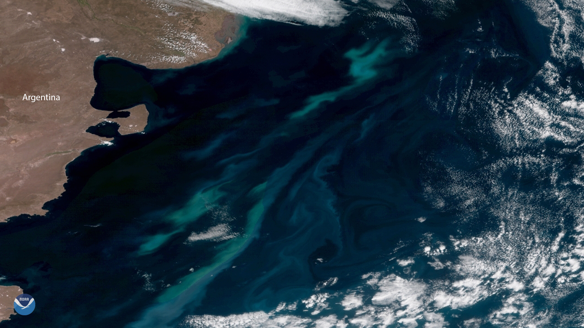
December is the beginning of summer in Earth's Southern Hemisphere. The long days and abundant sunlight help millions of tiny plant…
Satellite Snapshots
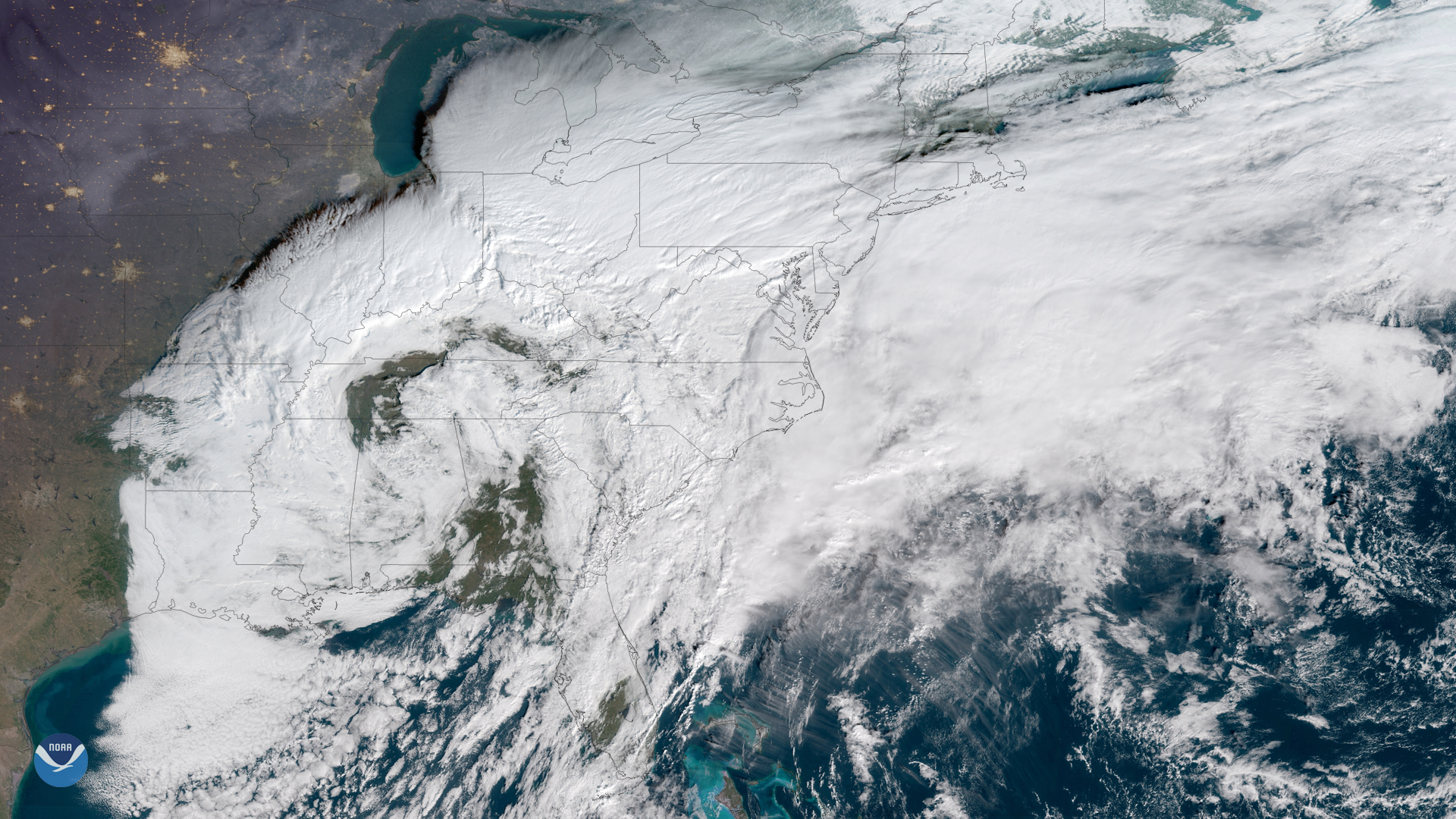
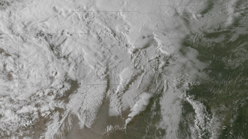
For much of 2018, satellite images have shown the Eastern U.S. covered in a thick blanket of clouds – and for good reason: Time and…
Satellite Snapshots
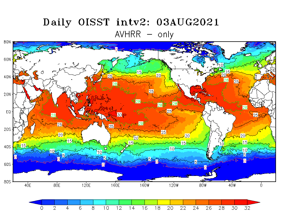
NOAA's polar-orbiting satellites are monitoring higher than average sea surface temperatures in the western North Atlantic.
Feature Story

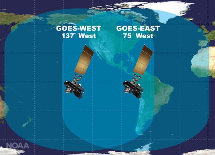
NOAA began monitoring sea level more than 20 years ago, with the TOPEX/Poseidon satellite in 1992. NOAA launched its newest in the series, Jason 3.
Feature Story
A year has passed since the Jason-3 satellite rocketed into space. NOAA's Laboratory of Satellite Altimetry provided us a report on those 365 days.
Feature Story
From thundersnow to upwards striking lightning, weather on Planet Earth can get pretty weird and NOAA’s fleet of satellites has…
Feature Story
Excitement is building for the launch of GOES-S. On March 1, 2018, NOAA’s newest geostationary satellite will launch into…
Feature Story
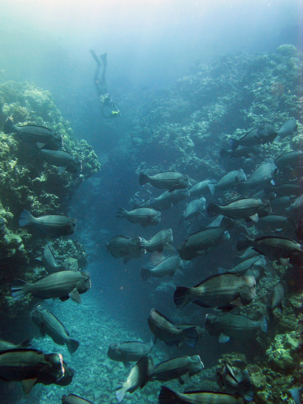
The ocean is home to critical coral reef ecosystems that provide a home to millions of plant, fish and marine animals.