
Earth from Orbit
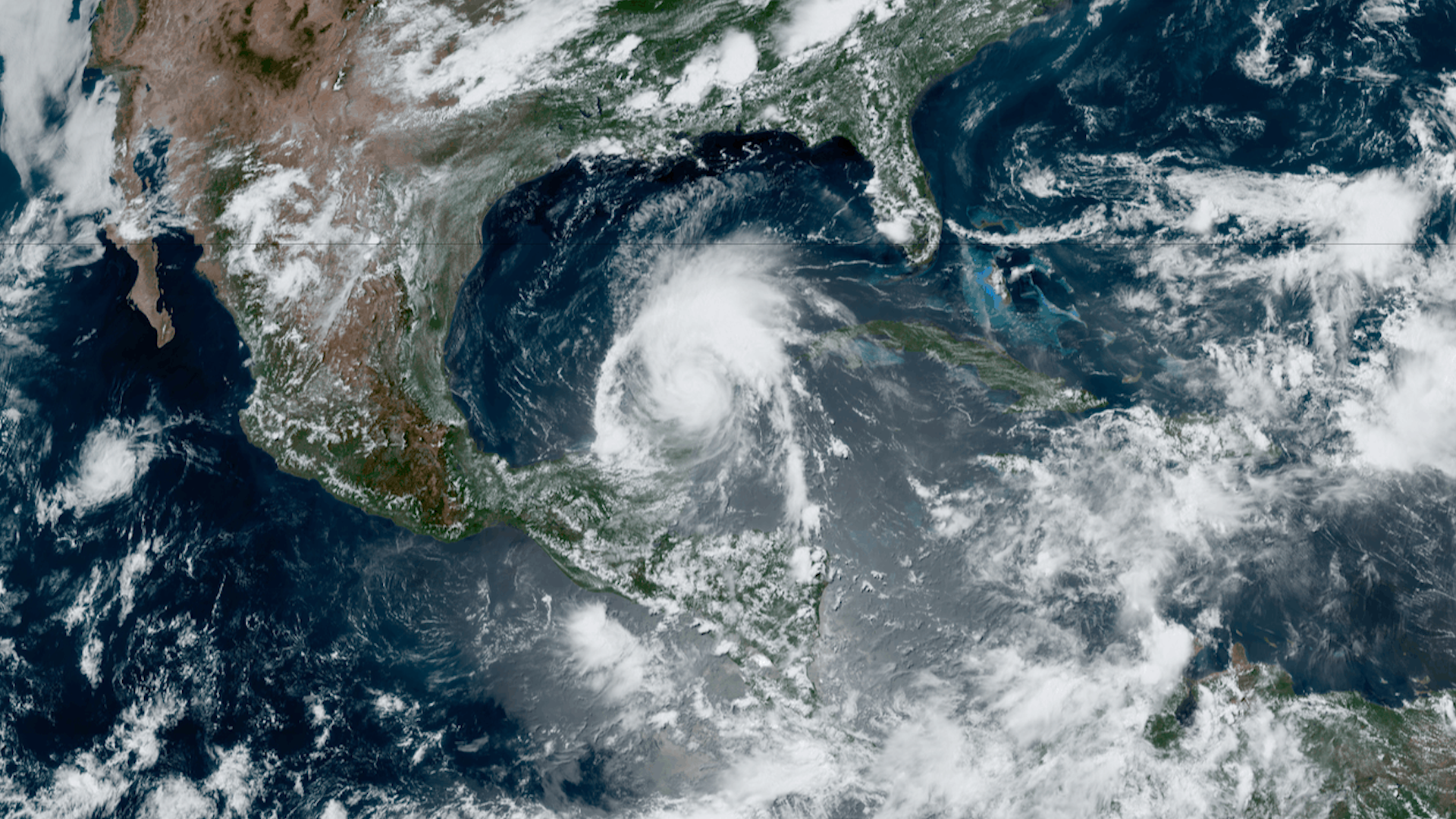
Hurricane Beryl, the first hurricane of the 2024 Atlantic hurricane season, rapidly strengthened to a Category 5 storm unusually early in the year.
Satellite Snapshots
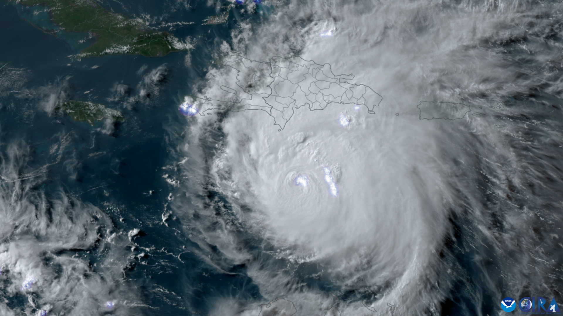
NOAA’s GOES East (GOES-16) satellite has been carefully monitoring Hurricane Beryl as it travels across the Caribbean.
Announcement

Atmospheric models assimilate ozone and trace gas data from JPSS instruments to improve real-time predictions of global air quality.
Satellite Snapshots
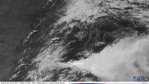
NOAA’s GOES East (GOES-16) satellite watched severe thunderstorms fire up along a dry line situated in west Texas and western Oklahoma on May 23, 2024.
Satellite Snapshots
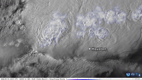
NOAA’s GOES East captured Texas storms from above in this visible imagery, which also shows frequent lighting observed with the satellite’s Geostationary Lightning Mapper (GLM) instrument.
Satellite Snapshots
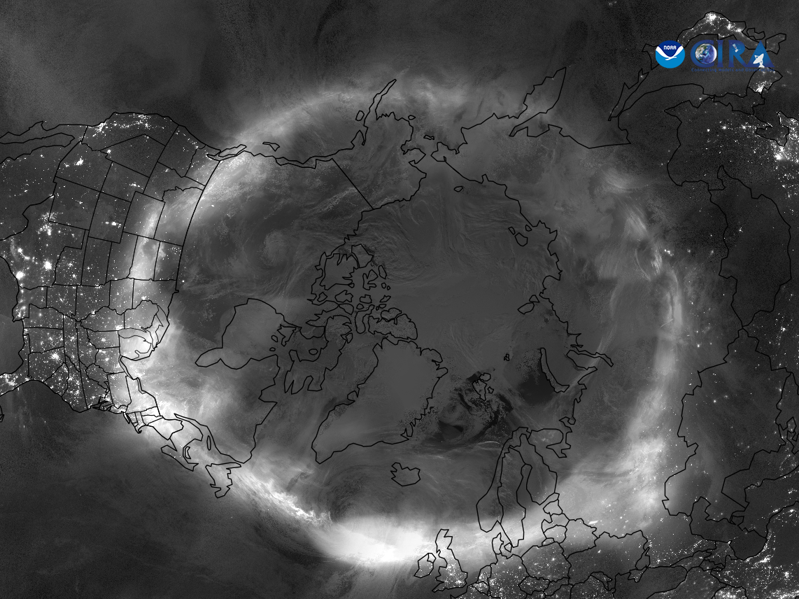
NOAA’s JPSS Program satellites captured imagery of the stunning auroras that were visible in locations across the globe on May 11, 2024.
Satellite Snapshots
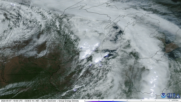
NOAA’s GOES East (GOES-16) satellite watched severe thunderstorms push across the Midwest that spawned several damaging tornadoes.
Satellite Snapshots
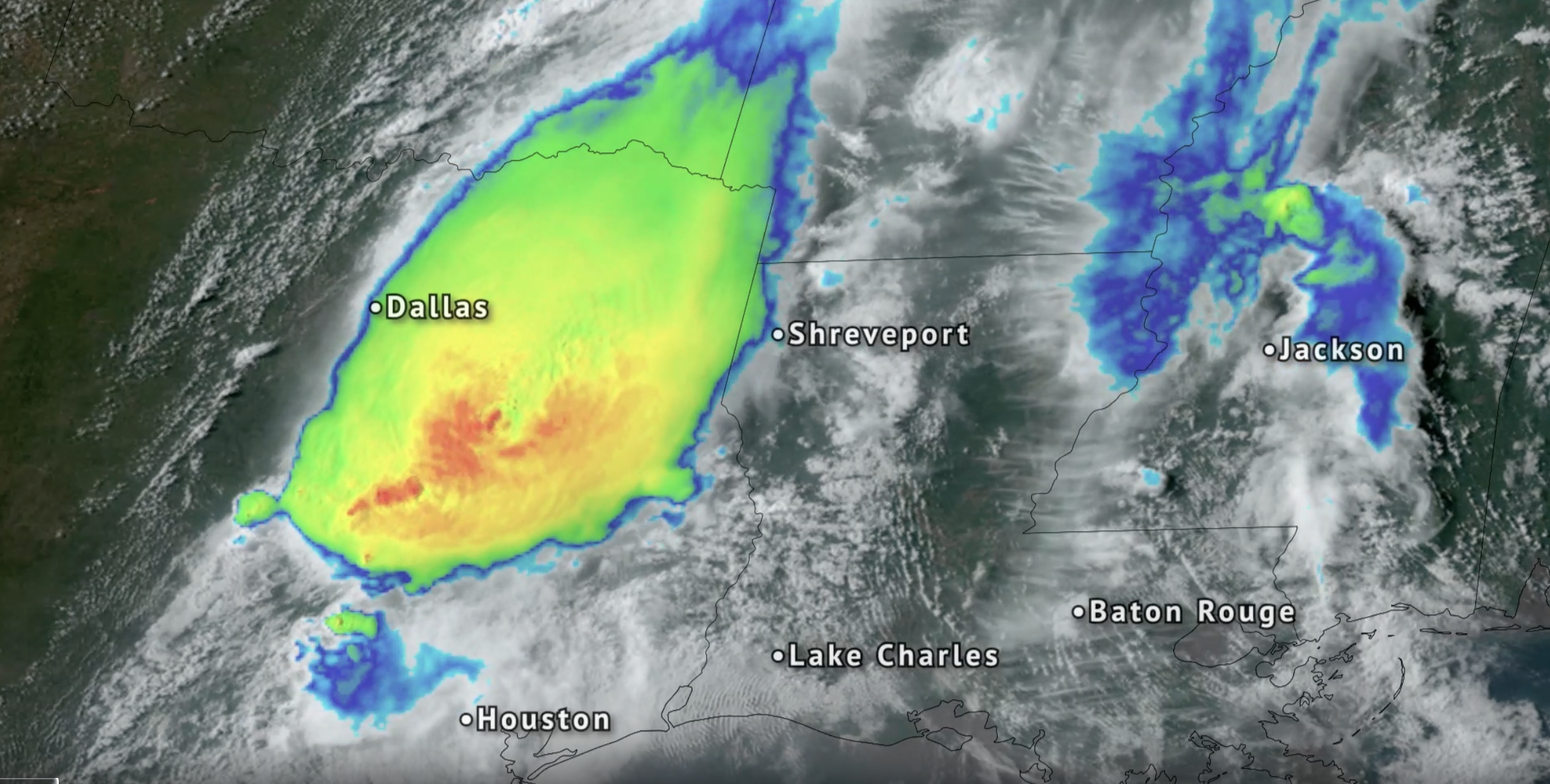
NOAA’s GOES East (GOES-16) satellite watched severe thunderstorms that brought tornadoes, damaging winds and flooding rain to eastern Texas and Louisiana from April 28–29, 2024.