
Satellite Snapshots
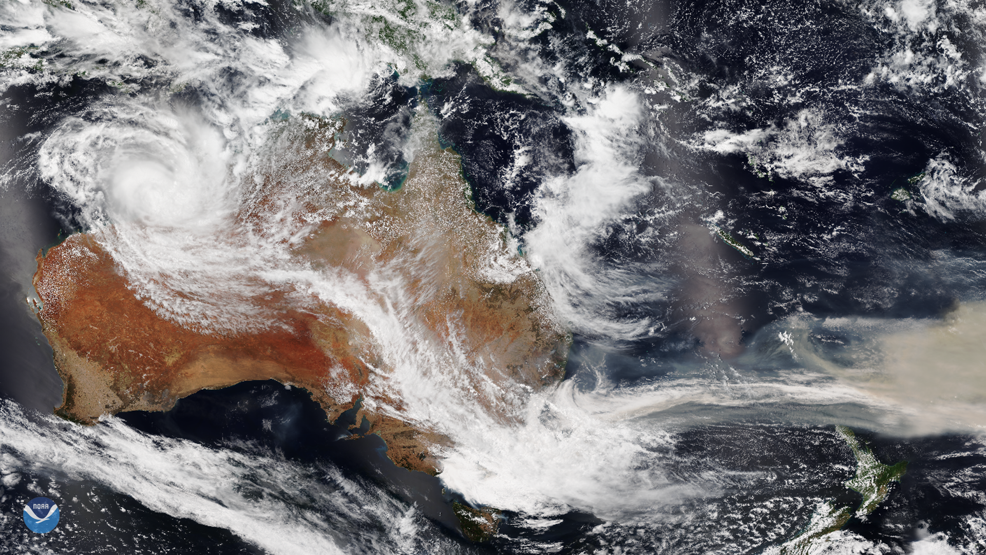
As wildfires in Australia continue to burn throughout the continent, sooty rain and cooler temperatures have finally brought some…
Satellite Snapshots
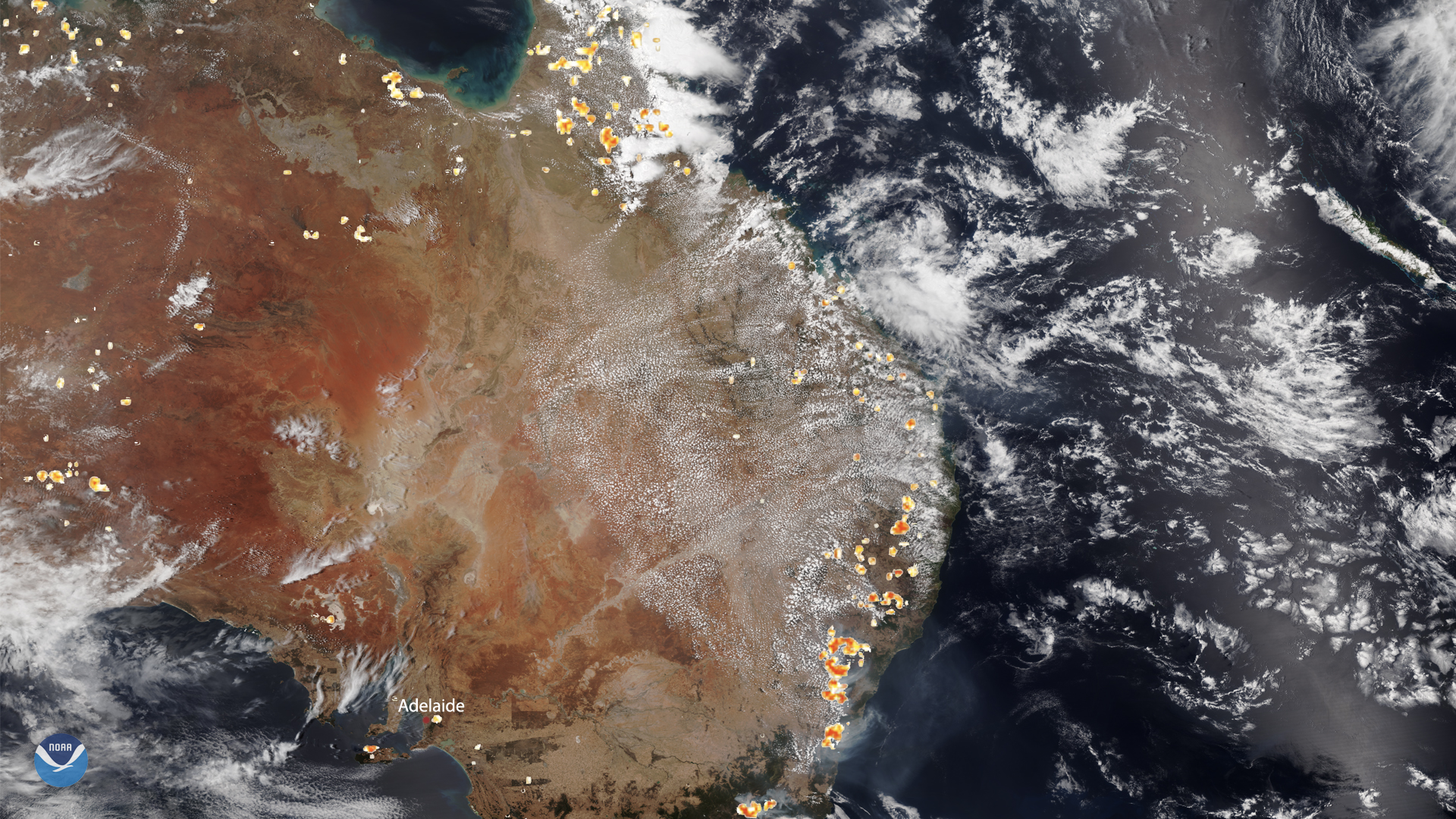
NOAA-20 captured this image of Australia on Dec. 26, where historic bushfires still rage in the southeastern states and territories…
Satellite Snapshots
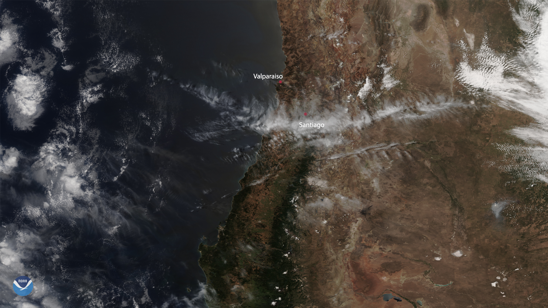
On Dec. 25, the NOAA-20 satellite captured the aftermath of the Valparaiso fires near Santiago, Chile. While they are believed to…
Satellite Snapshots
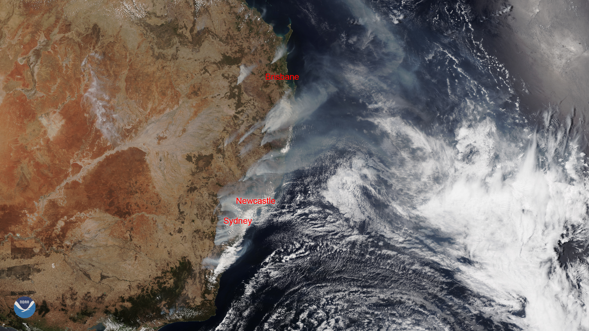
As massive wildfires continue to rage in the southeastern states of Australia, a dangerous heat wave is also moving across the…
Satellite Snapshots
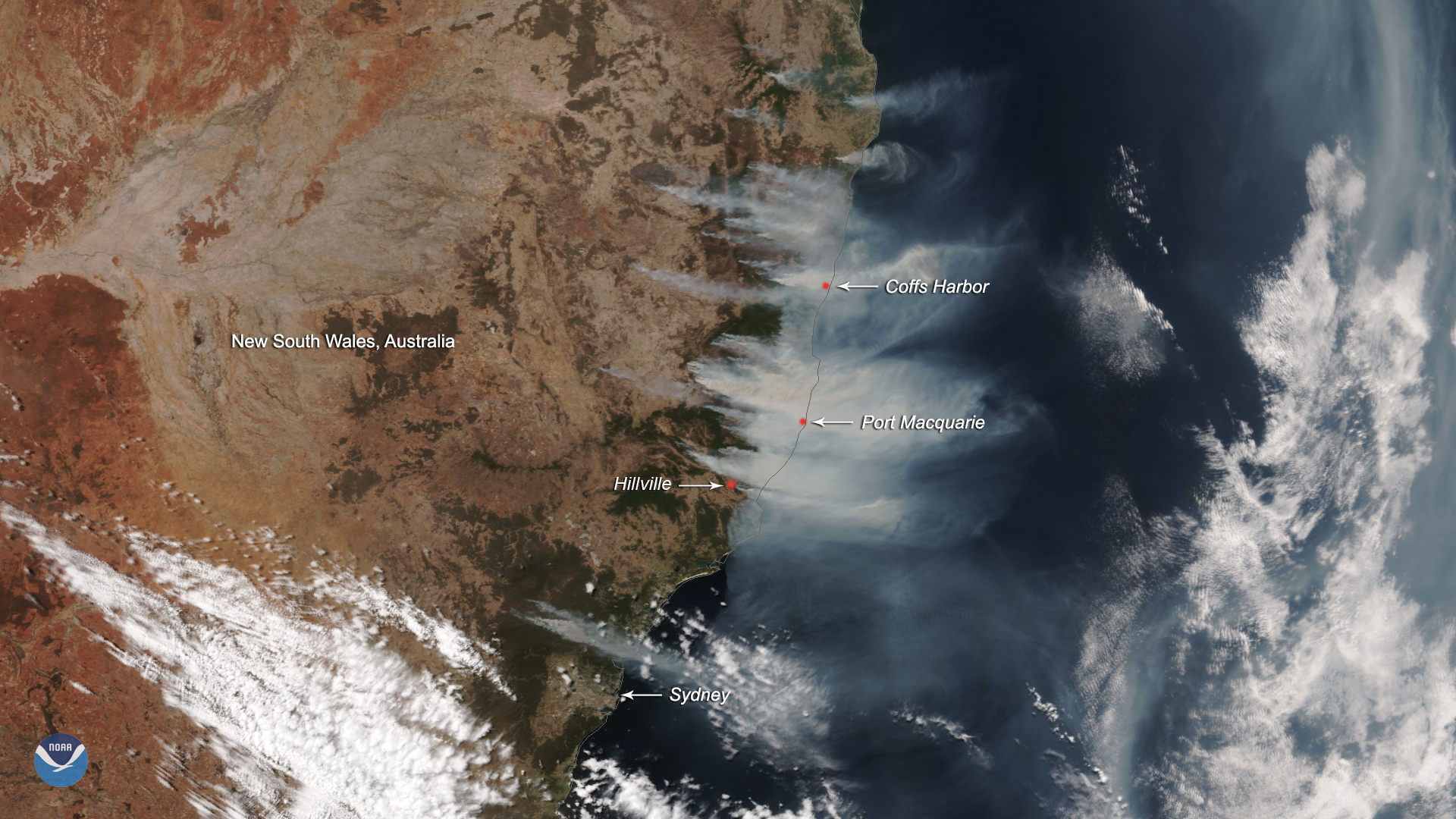
The Suomi-NPP satellite captured this True Color image of the eastern coast of Australia viewing bush fires.
Satellite Snapshots
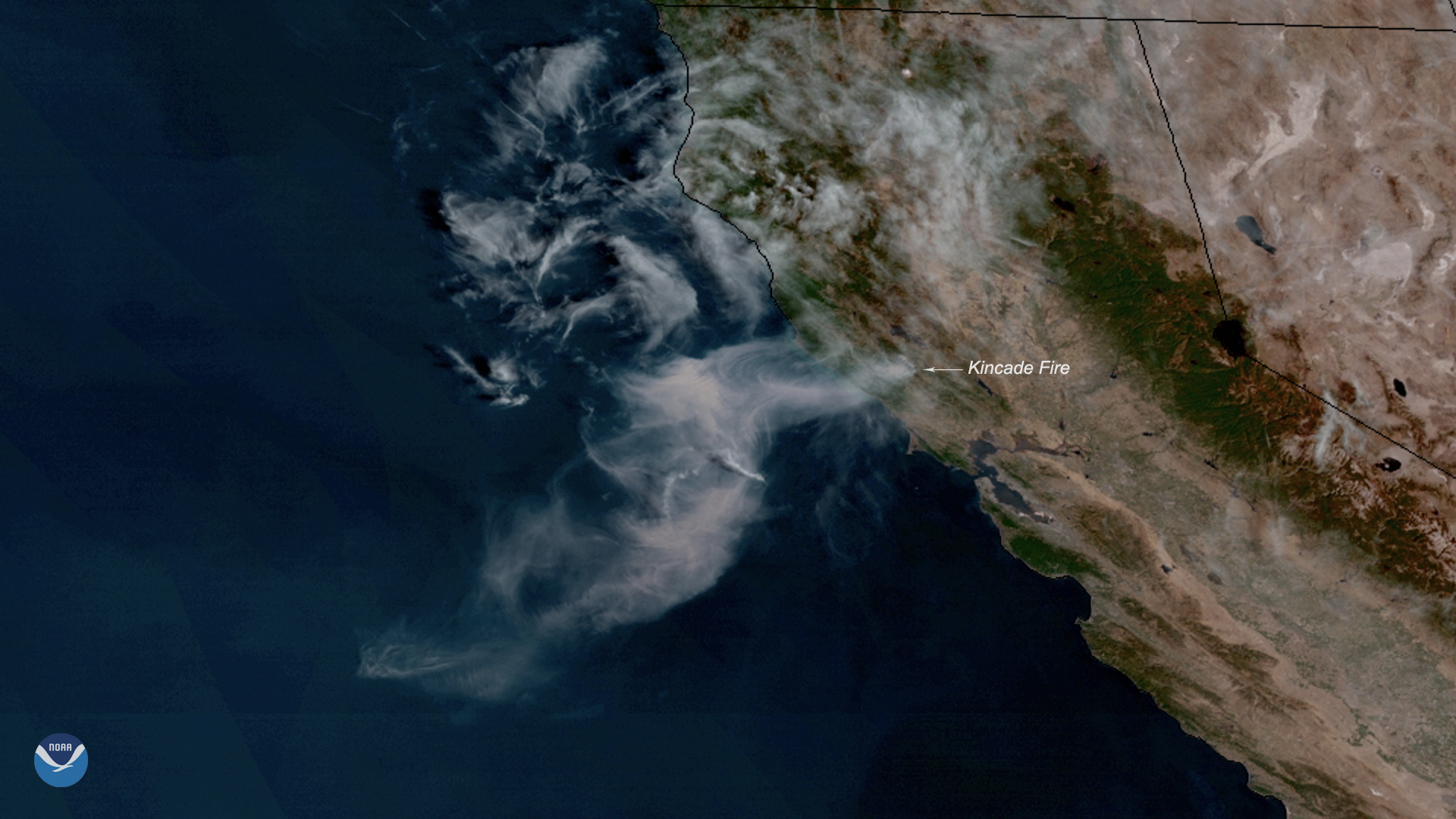
Neighborhoods across parts of Sonoma County, California, are under evacuation orders, and more are expected as the Kincade Fire…
Satellite Snapshots
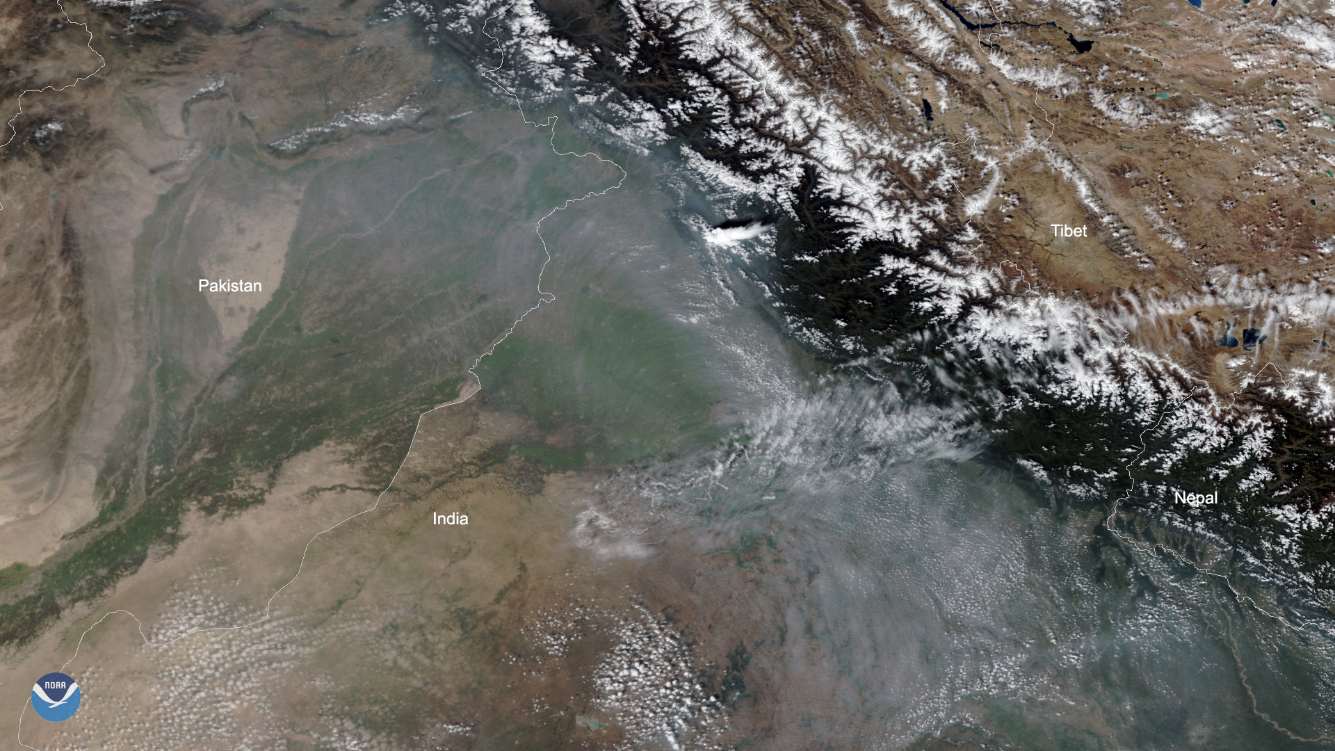
Smoke from fires in northeastern Pakistan and northwestern India can be clearly seen in this imagery captured by the NOAA-20…
Satellite Snapshots

The Suomi NPP satellite zoomed in on the Decker Fire in Colorado on Oct. 2, 2019.