
Satellite Snapshots
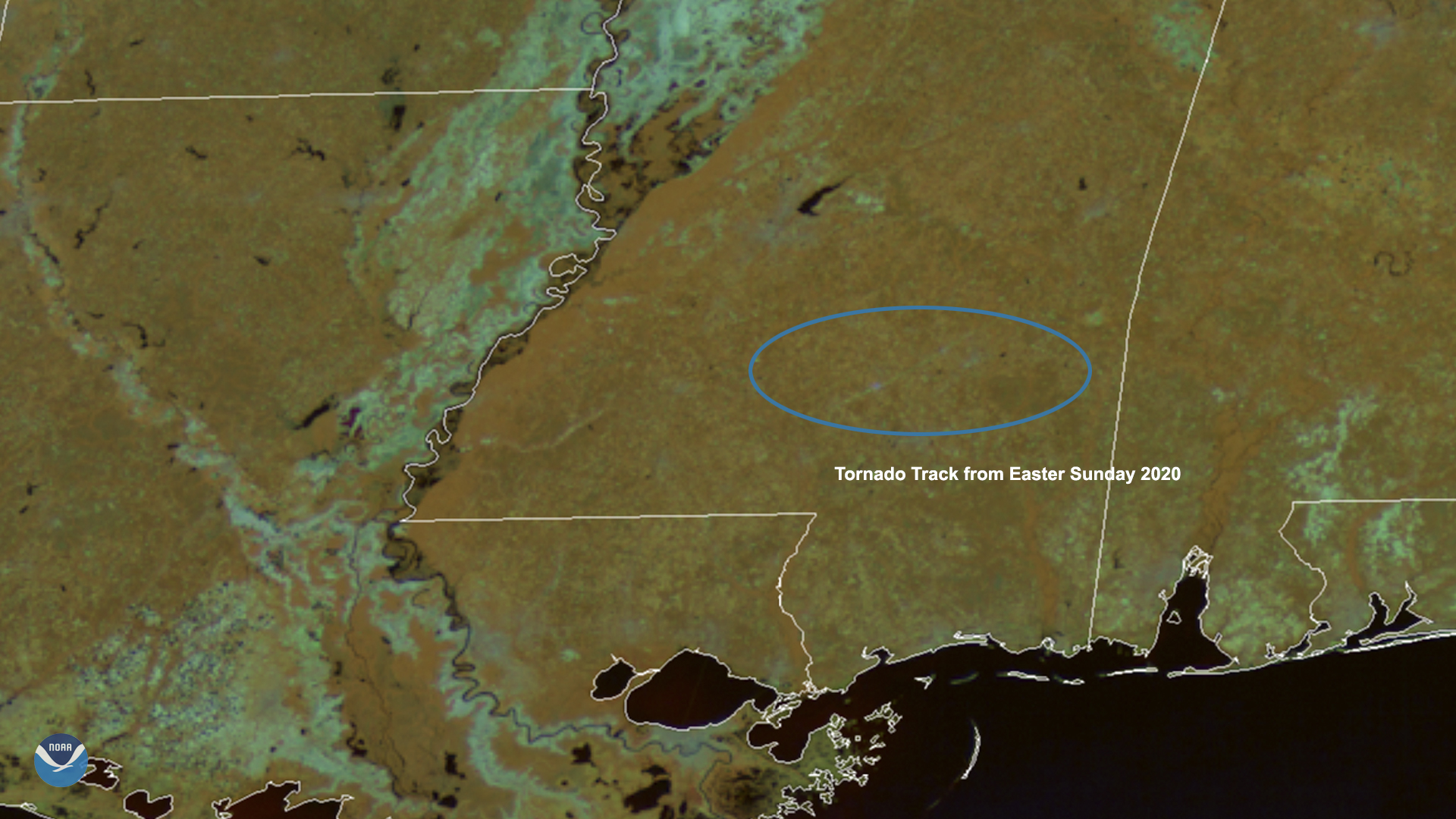
April 16, 2020 On April 16, 2020, GOES-East viewed the aftermath of an EF- 4 tornado in Mississippi, which caused a 68-mile-long scar across…
Satellite Snapshots
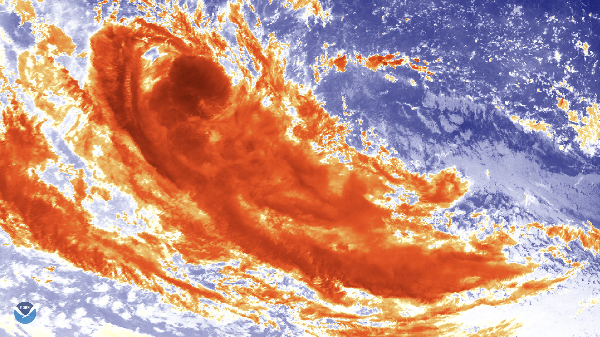
Himawari-8 satellite newly-formed Tropical Cyclone Jeruto swirling over the Indian Ocean via its clean…
Satellite Snapshots
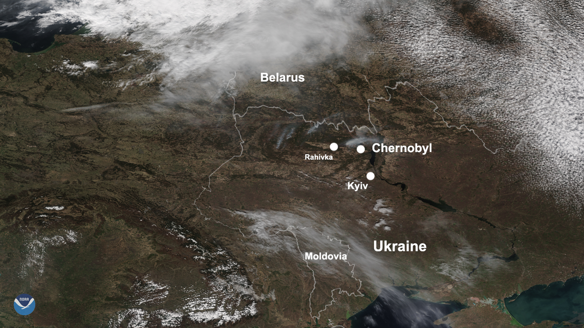
April 14, 2020 On April 12, 2020, NOAA-20 passed over Ukraine as severe blazes around the Chernobyl Exclusion Zone, and the capital city of Kyiv,…
Satellite Snapshots
GOES-East satellite has been monitoring severe thunderstorms that brought torrential rain, destructive winds.
Satellite Snapshots
April 10, 2020 On this day in 1815, Mount Tambora, seen here on April 10, 2020,by the Himawari-8 satellite produced the largest volcanic eruption…
Satellite Snapshots
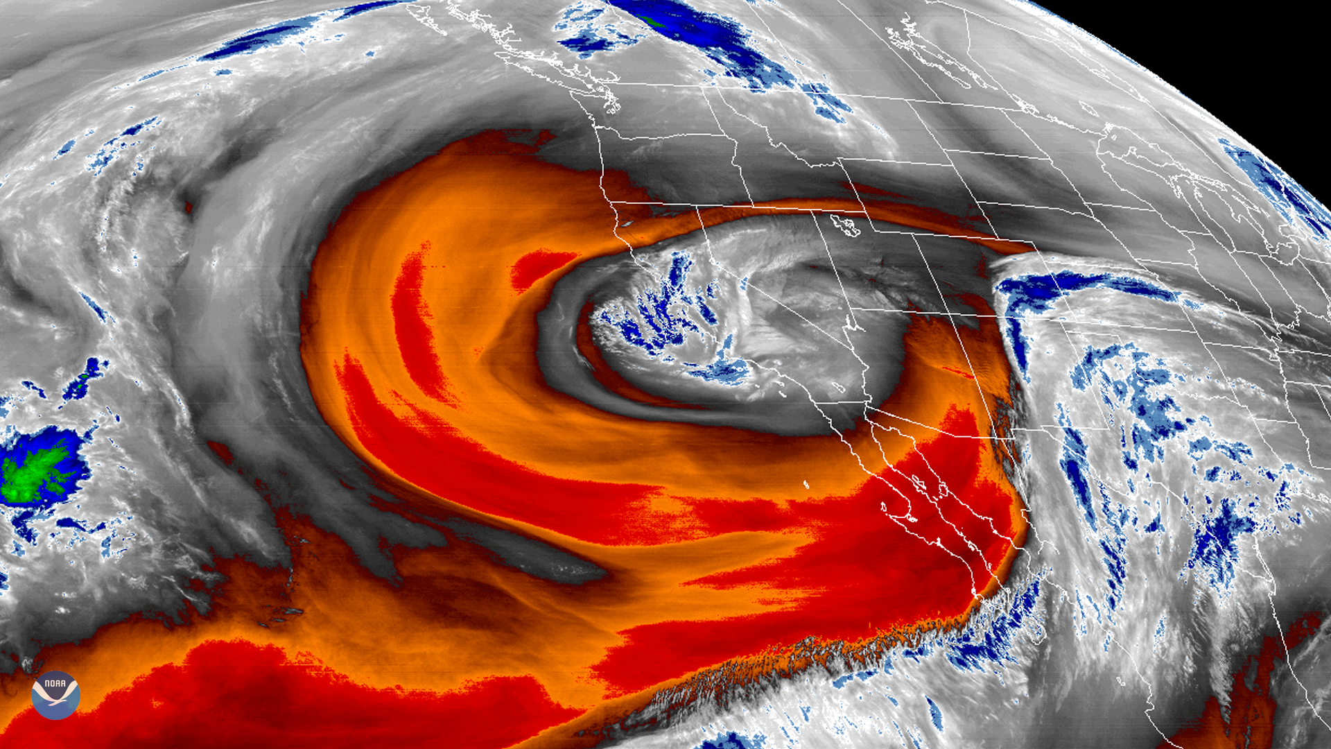
GOES West's water vapor band shows a low-pressure area off California that has become isolated or “cut off” from the main westerly air current.
Satellite Snapshots
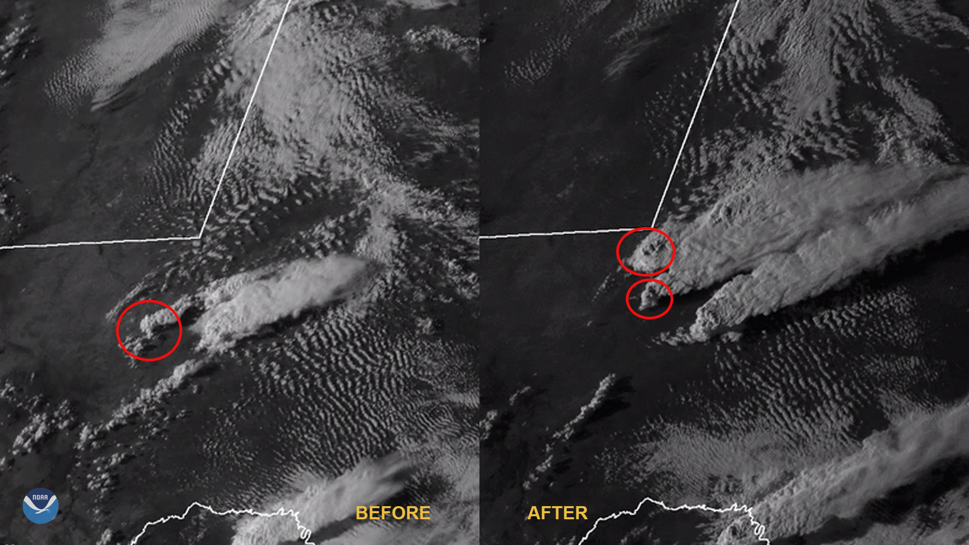
April 08, 2020 On April 5, 2020, NOAA-20 passed over Ukraine as fires broke out within and around the Chernobyl Exclusion Zone. It is believed that…
Satellite Snapshots
NCEI's global inventory of tropical cyclones, IBTrACS, lets forecasters analyze current storms in the context of historical data.