
Feature Story

To mark 50 years of GOES in orbit, NOAA is looking back at ten notable events captured by these groundbreaking satellites.
Feature Story
To mark 50 years of GOES in orbit, NOAA is looking back at ten notable events captured by these groundbreaking satellites.
Feature Story

NOAA satellites have witnessed some pretty extreme events, from massive wildfires and explosive volcanic eruptions to a 515-mile-long lightning flash.
Feature Story
NOAA satellites have witnessed some pretty extreme events, from massive wildfires and explosive volcanic eruptions to a 515-mile-long lightning flash.
Feature Story

A reanalysis of GOES-16 satellite data revealed a record-breaking lightning megaflash that stretched 515 miles across the southern U.S. in 2017, now certified by the WMO as the longest ever recorded.
Feature Story

LEO satellites provide essential ocean color data that supports sustainable fisheries and protects Alaska’s seafood economy.
Satellite Snapshots
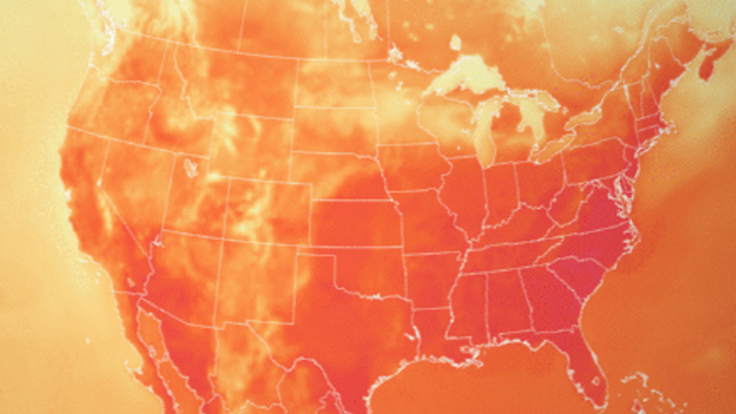
NOAA scientists have been monitoring a sweltering and record-breaking heat wave that has been sweeping through the Midwest and eastern United States using the Global Forecast System (GFS) model.
Feature Story

For 50 years , NOAA’s Geostationary Operational Environmental Satellites (GOES) have kept a constant vigil over the Western Hemisphere.